FAST AND CONVENIENT DELIVERIES!
OPTIMIZED IMAGING SOLUTIONS FOR DRONE APPLICATIONS
OPTIMIZED IMAGING SOLUTIONS FOR DRONE APPLICATIONS
In drone operations, different use cases demand different imaging solutions. Whether for high-resolution aerial photography, precise mapping, or industrial inspections, selecting the right camera is essential. Below, we present two top-tier imaging solutions optimized for drone applications: the Sony ILX-LR1 full-frame camera for ultra-high-resolution imagery and the YellowScan Explorer LiDAR for detailed 3D mapping.
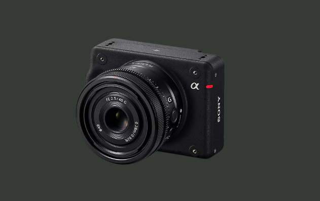
The Sony ILX-LR1 is a professional-grade, full-frame interchangeable lens camera designed specifically for industrial drone applications. Its compact and lightweight design, weighing approximately 243 grams, makes it ideal for aerial operations where weight is a critical factor.
With its DC 10-18V external power connection, the ILX-LR1 is ideal for long-duration drone operations, ensuring seamless data collection in various industrial and commercial applications.
LEARN MORE →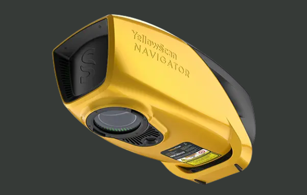
The YellowScan Explorer is a high-performance LiDAR system optimized for UAVs and light manned aircraft. It is designed for high-altitude and long-range scanning, making it a top choice for precision surveying, forestry, and infrastructure inspections.
The Explorer integrates a 360° field-of-view laser scanner developed by YellowScan and features the SBG Quanta Micro GNSS-Inertial solution for enhanced positional accuracy.
LEARN MORE →Both the Sony ILX-LR1 and the YellowScan Explorer provide cutting-edge imaging capabilities for drone operations. Whether your priority is high-resolution photography or accurate 3D mapping, selecting the right camera ensures optimal data collection and operational efficiency.
If you have specific requirements or need further consultation, feel free to contact us for expert recommendations on drone imaging solutions.
Get in touch!